The 26 types of geographical relief and their characteristics
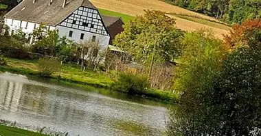
Mountains, beaches, marshes, capes, valleys ... the Earth, the world in which we are born and that shelters us, is a rich and varied planet in which we can observe a great amount of environments, landscapes and impressive places.
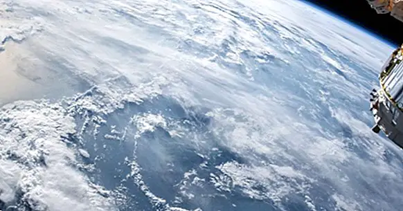
Within this wealth we can observe a large number of shapes and geographical features, caused by the movement of the tectonic plates and the elements that make up both the crust and the mantle and the core of the planet, as well as by the interaction between the earth and the waters. That is why throughout this article let's see the different types of geographical relief and its main characteristics.
- Related article: "The 6 types of ecosystems: the different habitats we find on Earth"
What do we call geographical relief?
Before entering to consider the types of relief that exist, it is necessary to take into account in the first place what implies the idea or concept of relief at a geographical level. It is understood as relief the set of forms and levels, elevations and depressions in a given object or element .
Taking into account the previous definition we can consider that the concept of geographical relief refers to the set of elements that are part of the structure of the planet and that shape the surface of the planet. This relief, which is studied by the discipline known as orography , arises from the interaction of the land with different types of agents: among them is the friction of tectonic plates, erosion caused by wind, water or living beings or the emission of organic or inorganic material by, for example, elements such as volcanoes.
The different types of relief on the surface
There are a great variety of different types of accidents and geographical reliefs in the world, both on land and sea. In this sense, below we will see some of the best known at the surface level, in the part of the orography that is not covered by the waters.
1. Depressions
Within the geographical reliefs are considered depressions to the set of geographical features in which the surface presents a sudden decrease in height or collapse in relation to the situation of the rest of the environment , sometimes even below sea level.
2. Plains
It receives the name of plain a type of geographical relief that is characterized by not having any type of elevation or undulation but is relatively homogeneous in all its extension. They are at a similar height or a little higher than sea level and usually originate before the accumulation of sediments after the waters retreat.
- Maybe you're interested: "The 8 main types of maps, and their characteristics"
3. Plateaus or plateaus
Land extension that similar to the plains is characterized by being relatively flat, but in this case is located at high altitude. Often these are regions of eroded territory that are located or are formed in ridges or other elevations of similar terrain. While a plain is not more than a few hundred meters above sea level, a plateau can be thousands or in full mountain.
4. Valleys
The valleys are the type of geographic relief that appears between two mountainous formations, and that supposes a descent or depression of the land between both mountains. Generally they produce as a result of the erosion generated by fluvial or glacial courses. They can have very different forms depending on the type of erosion and the time it has been receiving.
5. Dunes
Although when we speak of geographical relief we usually imagine rocky elements, the truth is that we can not ignore the existence of a type of relief mainly generated by erosion and shaped by sand. This is the case of the dunes, elevations of the terrain generated by accumulations of sand and that may eventually disappear or modify its shape or position thanks to the action of forces such as wind.
6. Hills, hills or mounds
Receive any of the aforementioned names the type of geographical relief formed by a slight elevation of the ground that does not usually exceed one hundred meters in height and whose slope is usually softer than that of a mountain. Even so, it is possible that they are steep.
7. Mountains or mountains
It receives the name of mount or mountain those elevations of the terrain that generally arises from the accumulation of rocky material that arises from the union of two tectonic plates (although also they can be formed by the accumulation of the emissions of a volcano, for example). They are characterized by their high altitude and by the fact of having a variable but high slope level , being able to distinguish a foot or base and a top or peak.
Although at a popular level it can be thought that the mountain is a small mountain, the truth is that they actually refer to the same concept except for the fact that while mountain is used to talk about an isolated elevation, the mountain tends to refer to one that is located among a group of them.
8. Cliff
It is considered as such that geographical feature in which the terrain is cut vertically, in such a way that it appears a sudden fall or descent in the form of abrupt depression in which two clearly differentiated levels can be observed. It can be seen, for example, at the mountain level, but also on the coast.
9. Saws
It is called as a mountain to a group or group of mountainous elevations that appear very close to each other and that generally have a very steep slope.
10. Cordilleras
Mountain range is denominated to the type of geographic relief in which they appear a great amount of mountains or linked mountainous elevations, habitually of greater altitude that in the case of the mountain range. They usually arise in the places where there is the greatest shock and friction between the tectonic plates , rising the ground before the pressure of one against another.
Main types of coastal and marine relief Below we indicate a series of the main types of relief that we can find at sea level or in direct contact with it.
11. Beach
It receives the name of beach the geographic relief characterized to be the point of union between the terrestrial geography and the maritime one, which is at sea level. It is characterized by being a relatively flat or flat area with a variable slope in which the terrain is sandy or rocky due to the erosion caused by the waters and the rubbing of marine materials.
12. Island
We know as an island the type of geographic relief characterized by the presence of a fragment of emerged territory which is completely surrounded by water (not necessarily at sea level). In it can also appear different geographical features such as those discussed above.
13. Archipelago
It receives the name of archipelago the geographical formation consisting of a grouping of islands close to each other and often linked , although separated by bodies of water.
14. Peninsula
The term peninsula refers to a non-submerged area of land and part of the continental orography which is surrounded by water in all directions except for one part, which connects with the rest of the landmass .
15. Cabo
It receives the name of corporal that earth mass that goes in direction in the sea beyond the rest of the surrounding land, which can have a variable size.
16. Bay
It is understood as such the type of relief in which the waters of the sea penetrate and occupy an area of the earth , being this water surrounded by earth except for the end by which the water penetrates. It would be the reverse of the peninsula.
17. Gulf
We understand as such a geographical feature similar to the bay, but with the difference that it usually refers to concave areas in which the sea gains ground and that are generally surrounded by it except for a portion in which It is in contact with the sea or ocean. It is generally considered larger than the bay, although the concept is practically identical.
18. Cove or inlet
This type of geographical relief is conceptualized in the same way as the bay, with the exception that It usually has a circular shape and that the point by which water enters and penetrates the earth is a relatively narrow mouth.
19. Narrow
The narrows are geographical elements configured by bodies of water surrounded by land that act as a channel or bridge between two other water bodies, allowing the passage of the liquid element from one to another.
20. Estuary
We define estuary as the geographical region located at the mouth of a particularly large and broad river, forming a funnel-shaped area that is formed due to the entrance of seawater slows the flow of fresh water from the river for later when there is low tide allow its exit with normality.
21. Delta
Geographic area that usually appears at the end of a river's path, at its mouth, and that is characterized by A softening of the orography due to the deployment of river sediments .
The different types of underwater relief
Below we will show some of the main examples of types of geographical relief that can be found below sea level, all of them submerged.
1. Continental shelf
We know as a continental shelf that region of the earth's crust that it corresponds to the terrain of the continent that serves as the base for the emerged terrain above the water level. It is therefore the part of the continents that is submerged
2. Continental slope or batial zone
Geographical relief that is characterized by the presence of a very pronounced inclination of the sea floor, being the part of the ground that slopes down from the continental shelf to the abyssal plain.It is between 200 and 4000 meters underwater.
3. Abyssal plains
We denominate abyssal plain to the part of the terrestrial orography that corresponds with the terrestrial surface located between 4000 and 6000 meters deep , in which sunlight stops illuminating the ground.
4. Abyssal graves
They are called abyssal pits those depressions that can be found in the abyssal plains, which are part of the so-called hadal zone of the ocean and in which high levels of pressure makes life difficult.
5. Underwater dorsal
We call submarine ridges to the set of mountain ranges that, unlike what happens with terrestrial ones, It is located below sea level . Although generally we do not see them in our day to day, they have greater height than those of the surface.
Bibliographic references:
- Newell Strahler, A. (2008). Visualizing Physical Geography. New York: Wiley & Sons and The National Geographic Society.
- Bielza de Ory, V. (Editor) (1993). General Geography I. Madrid: Santillana.