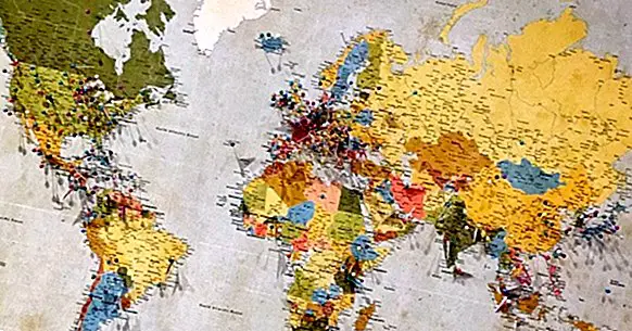
The 8 main types of maps, and their characteristics
The different types of maps that exist they give account of the complexity of the territorial organization of the human beings and of the regions that we inhabit. These elements related to cartography can adopt the most unsuspected forms, depending on the criteria that have been used to design them.
In the next lines we will see a summary of the different kinds of maps going beyond the simple classification that distinguishes between the electronic map and the physical one.
- Related article: "The 13 types of text and their characteristics"
The main types of maps
Here is a classification of the most popular types of maps.
1. Political map
This is one of the types of map in which physical elements are not represented, but rather only political territories and their limits appear: the borders . In them appear States or regions with a certain sovereignty and self-government. Regardless of the scale of what one wants to represent, be it a county or a supra-state organization, emphasis is placed on the notions of "inside" and "outside."
In cases where there is a territorial conflict that creates discrepancies between many parties involved, the borders are represented by dashed lines, a representation resource that is often used to mark the edges of a country's territorial waters.
Of course, as in a political map appear mainly theoretical constructs, to realize one it is necessary that they exist certain consensus on the limits of each political entity represented .
- Maybe you are interested: "The 4 main branches of Anthropology: how they are and what they investigate"
2. Geographic map
Being probably one of the most used types of maps, try to give the information considered most relevant in most cases with regard to the physical elements of a territory, including scale representations of natural surfaces or built by human beings.
Normally, what you see in one of these maps is what you would see from a zenith perspective if you were to adopt a perspective of space from a very high point of view. You try to achieve a good level of realism.
On the other hand, the size of what you want to represent can vary a lot, going from the entire land surface to the area occupied by a single municipality .
3. Topographic map
This type of map is characterized by highlighting height differences (expressed in contour lines) and in general the relief of the earth's surface . It is also common to use coloring patterns to mark the space occupied by different kinds of geographical features.
4. Geological map
This type of map can be similar to the topological, since it represents natural elements, but in this case there is not so much emphasis on the relief and the shape of the earth's surface, and the type of minerals that make up the land. The latter is expressed many times using icons as symbology for the different minerals and natural formations such as springs, volcanoes, special mineral veins, and the like.
Thus, the variations of the territory that appear have to do with the characteristics of the mineral distribution and the shape of the tectonic plates. In general, it is about giving an image of both what is on the surface and what is underground.
5. Climate map
In this case, it is a matter of highlighting the climatic differences between regions. This is done by coloring in a homogeneous way each zone that shares the same type of climate, sometimes creating overlapping areas (in which several colors are mixed using patterns of thin stripes.
6. Urban map
Urban maps put emphasis on the elements of urbanized areas, that is, constructions made by humans and pedestrians and vehicles, to the point that in many cases nothing more than that appears, with the exception of natural elements such as coasts and rivers.
So, normally they represent only the space occupied by a city, district or neighborhood , everything to scale. The type of graphic elements used for this purpose are usually simple and minimalist, in most cases using only polygons.
Sometimes color changes are used to indicate the presence of different types of spaces: old center, parks, beaches, etc.
7. Transit map
This is a variation of the urban map that almost exclusively represents the layout of the public transport routes of a city, in a very simplified way. The routes of buses, trains, metro networks, and trams they are represented with colored lines, and the stations are marked for the main means of transport.
8. Weather map
This is the support used to show what the meteorological phenomena are or are going to be in each region, being represented with symbols that represent rain, storm, cloudy, etc. Due, the representation of the territory is usually simple , created only so that each region can be easily recognized without the need to include more information not related to meteorology, something that would saturate the image visually.
Bibliographic references:
- Cosgrove D. E. (ed.) (1999). Mappings London: Reaktion Books.
- O'Connor, J.J. and E.F. Robertson (2002) .The History of Cartography. St. Andrews: St. Andrews University.